Over recent months I’ve taken to the road heading about the Highlands on my road bike. Here’s one of my favourite runs from Inverness. The ride takes you down the south side of Loch Ness, up on to the moorland to around 800ft and back down to Inverness across beautiful open country.
Here’s my photographic journey of the trip

The journey takes in great views of loch ness, one brutal hill, and an easy return to the city of inverness over quiet country roads.

We set out in the middle of Inverness and cross this walking bridge over the river with views of the castle and as many tourists as you can shake a bicycle pump at.

In couple of miles you are on the edge of town and about to leave suburbia behind.

Soon you leave the main road and are riding along minor single track roads without a car in sight or even other cyclists. Loch Ness is tucked away beyond the fields and before the green ridge rising to the right of the photo.

After about 8 miles you arrive at the small village of Dores nestling beside Loch Ness. I was using my little android tablet and had MAPMYRIDE switched on for the first time. Unfortunately I couldn’t find “stopping for ice cream.” button but I’m sure there is one. They sell nice chocolate ice cream here, there’s also loos and you can fill your water bottle.

I had a great day for the ride but, trust me, the weather is like this most of the time.
Well the fun had to end some time. This is the beginning of the Hill of Pain where strong men weep and I keep telling myself that this must be getting me fit. The hill rises around 700ft and climbs away from the Loch and up on to the hill country that surrounds Inverness.
Drumnadrochit Bay looking down from the hill across Loch Ness

Unless you are an annoying skinny fit person, which I’m not, (Well I might be the annoying bit) you’ll be glad to get here where the road finally levels out. If you turn right you will, eventually get to Fort Augustus but there are numerous small roads winding their way between lochs and hills that offer some of the best cycling in Britain.

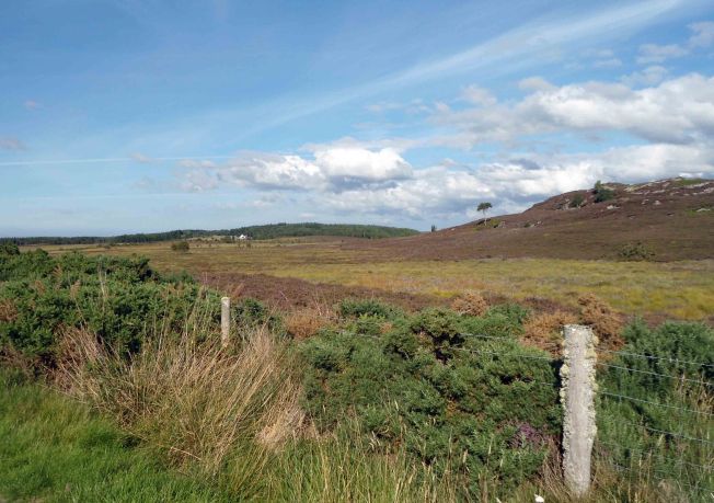
Now the landscape changes and you leave farmland and cross the open moorland of the High country. Don’t be too keen to rush this section. Half a mile from the T junction on the right hand side of the road is a small loch, largely hidden from view. More than once I’ve seen Osprey hovering here looking for lunch.
Finally you end up back in the outskirts of Inverness.
The whole route is a little over 22 miles with a climb of 1000 ft. it takes me over two and a half hours with stops to take photos, eat ice cream, pick mushrooms and gasp a bit here and there. I think it’s well worth the trip very varied and, at times, quite remote.
If I was clever I’d add a map but I’ve not quite worked out how to do that yet. Any advice welcomed.
Enjoy


Do you have a garmin bike computer?
No, I have an app on my android. Map my ride, seems to work well.
Do you have a garmin bike computer?
No, I have an app on my android. Map my ride, seems to work well.
I love the Dores/Foyers side of Loch Ness along General Wade’s road and would love to cycle it one day. In fact, I think I’d quite like to cycle the Great Glen in it’s entirety. But, my solution to ‘The Hill of Pain’ would be to get off and walk up it – I feel absolutely no shame in doing that and do it all the time for long or steep hills. In fact, if I find a hill particularly steep, I may also walk down it too! (I’m a bit of a cycling coward too).
Carol.